Clues Over Koattey
Words by Daniel Bosley; Pictures by Aishath Naj
The Koattey area of Hithadhoo in Addu atoll is famous locally for its biodiversity, incorporating rich reefs and the Eidhigali Kilhi wetlands. The delicate ecosystem of this uninhabited area is now legally protected, with developments currently underway to increase visitors to the northern-western tip of the Maldives’ southernmost atoll.
But it may be more than the mangroves and maakana that benefit from this protection. Less well understood, but equally endangered, Maldivian history still lives aside the jungle trails, amidst the swamps and scrubland.
Far from being an untouched area populated only by fragile fauna, ample evidence of homo sapien habitation can be found in the area. Indeed, our interest in locating a 16th century fort – examined by the British archaeologist HCP Bell in 1922 – quickly led us through 1000 years of Maldivian history.
The full significance of Bell’s fort is unclear, with reliable historical sources a rarity, particularly concerning history away from the capital, Male’. Bell himself was told (in Male’) of a Kalu Ibrahim Thakurufaanu of Gaafaru who is said to have taken refuge in the area after a dispute with the Sultan during a particularly fractious royal period in the early 1500s.
Others suggest that Francois Pyrard’s mention of a fortress in ‘Souadou’ (perhaps referring to the whole of the South) may correspond to Koattey. This (less likely) explanation would link the area to the anti-Portuguese campaign waged by the independence hero Mohamed ‘Bodu’ Thakurufaanu. (No relation to Kalu Ibrahim…Thakurufaanu being a sort of title. But you see how quickly things get confusing?!).
Alternatively, tales of Kalu Ibrahim taking up residence in Hithadhoo may even link the two Thakurufaanus. Ibrahim is said to have been step-father to Bodu Thakurufaanu’s arch-nemesis and national villain, the Portuguese Andhiri Andhirin, who was shipwrecked in Huvadhu while still in the womb. Perhaps this famous figure spent his formative years in Koattey, plotting his revenge.
One thing is for sure, these vague details are open for endless debate and will probably never be agreed upon. What we do know for sure is that the Dhivehi word Koattey actually translates as ‘fort’; we know that Bell came, found, and photographed the structure almost a century ago; and we know that no one today seems to be able to tell us where to find it.
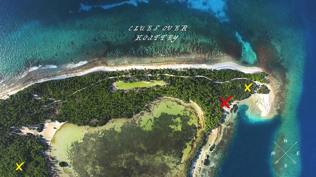
So, after creating our own map based on Bell’s 94-year-old notes (and Google Maps, obviously), we set out to find some of Koattey’s cultural treasure in the following locations.
- Those on the extreme north-east of Hithadhoo island
- …with beach to the east, preferably within 30 yards
- …with a bedi (shallow lagoon) area to the west
- …with the graves of two drowned persons to the north
- …and with evidence there had been no tree cover as recently as 1922
Site One: ‘English House’
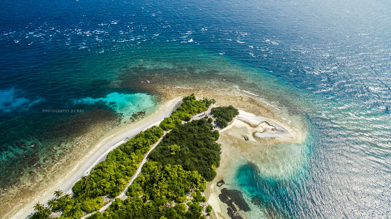
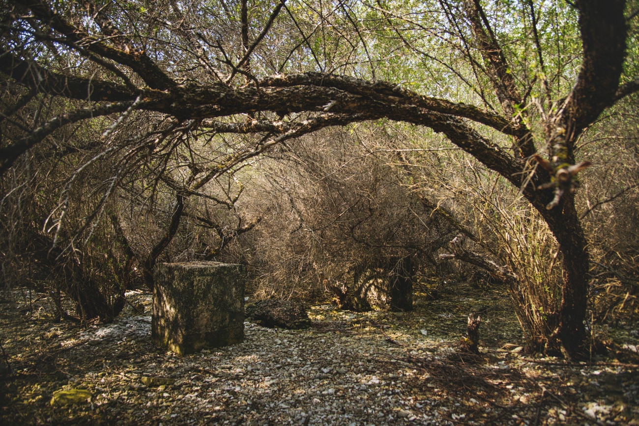
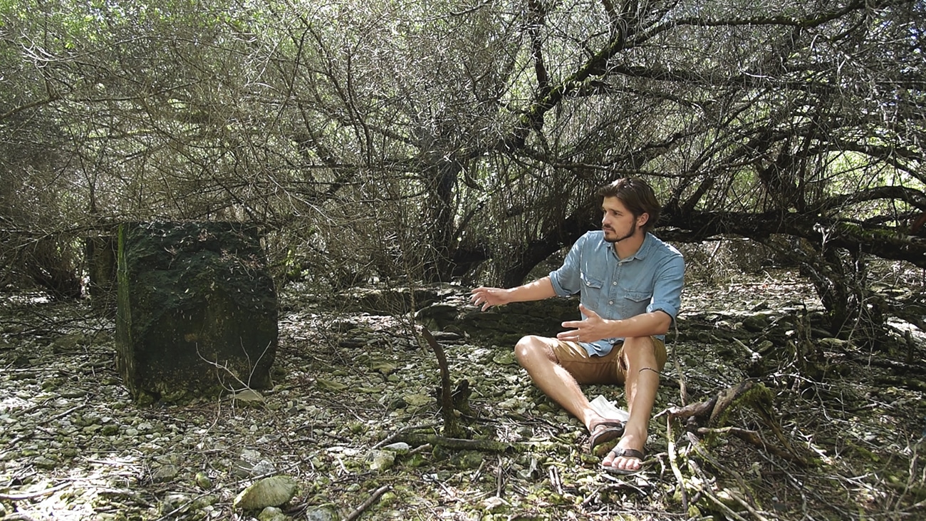
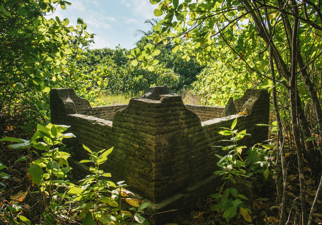
An aerial view of Koattey quickly drew our attention to a site on its eastern edge, with tree cover that dramatically changes in colour just before the island gives way to the reef (see aerial pic above). Heading here, the remains of a modern brick structure are immediately visible from the path to anyone who glances down to the right while on their way to snorkel, picnic or fish.
A few crouching steps underneath the low branches reveal a neat brick wall standing just a few inches tall, with four concrete blocks – embedded with rusty metal – on the remains’ eastern side. This is clearly not Bell’s 500 year-old fort. So what is it?
During WWII, Addu was temporarily transformed into ‘Port T’ – a British military base designed to stave off Japanese incursion into the Indian Ocean. As the war moved east in 1943, men, materials and Port T’s floating telecoms facility followed, leaving the secret facility requiring land-based communications.
Peter Doling’s excellent book on the period suggests that up to 10 towers – complete with radio and radar rooms – were commissioned in 1944, though only four were ever completed. Locals today also recall a medical facility existing in the area around the same time, suggesting the site may have had multiple uses during the period.
Forty years after, the Norwegian adventurer Thor Heyerdahl was also led to this site when searching for something far older (in his case, pre-Buddhist sun worshippers). His local guide was proud to present the crestfallen explorer with ‘an English House’.
It was an early reminder in our search of Koattey’s long history of strategic importance in defending the atoll, overlooking the vast Equatorial Channel to the north as it does. But our treasure hunt was only just starting.
Site Two: ‘The Graveyard’
On our way to the second site we stopped at Vehera Fannu, where the jungle path meets the northern beach. As well as its name reminding us of those Buddhist communities Bell so keenly sought out in this area (‘vihara’ being sanskrit for Buddhist monastery), we had also been told that there was a grave nearby that might be of interest.
We soon found, just a few yards away from the beach, the simple and solitary grave of Ahmed Manikufaanu, laid to rest in a manner typical of those drowned at sea. This kind of grave site – a result of concerns both superstitious and sanitary – is similar to those described by Bell as lying to the north of his fort.
Inquiring with one of Koattey’s caretakers about areas of potential interest, we soon found ourselves riding past farms and through tall grass due south of Vehera Fannu. As an area conspicuous for its lack of tree cover, we had searched here before, but conceded defeat to the intolerable tropical sun which Bell had described so vividly a century earlier. With a little inside knowledge, however, we headed this time into the stifling shade of the brush to the north of the clearing, finding another hidden gem.
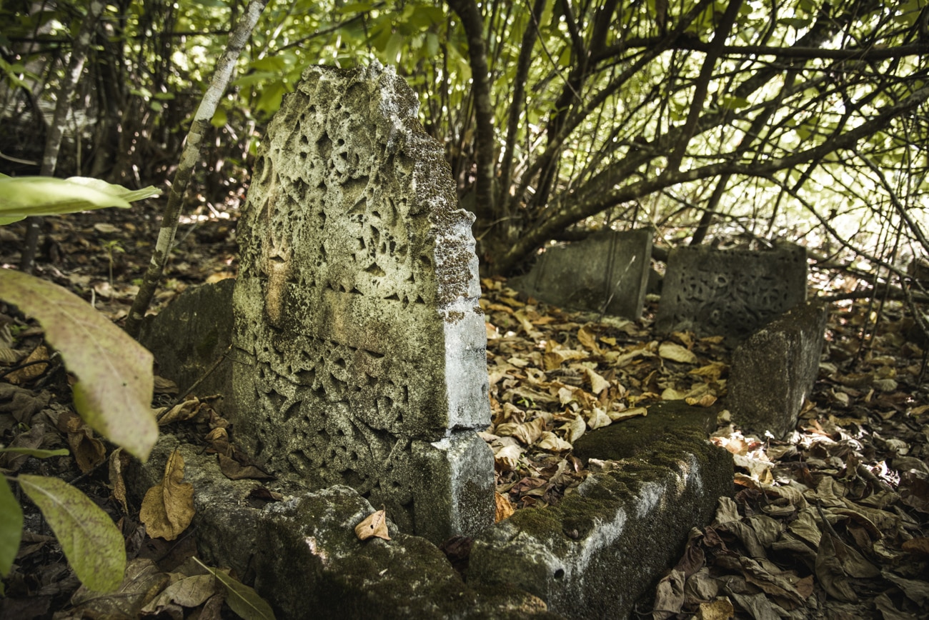
Way off the sandy beaten tracks of Koattey, the graves we were now shown gave a glimmer of hope that we may have found the site. However, as well as being a little far from the beach and the bedi, these graves were far more elaborate than those described in Bell’s monograph.
Up to a dozen headstones could be seen without delving deeper into the undergrowth, and with what appears to be the foundations of a mosque close by, it seems highly unlikely any archaeologist would have overlooked such a find in his write-up.
We’d found more evidence of relatively recent communities in the area, but not of the 16th-century-fortress kind. Hot but undeterred (okay, slightly deterred), we hopped back on the bikes as the caretaker offered to show us another of the area’s secrets.
Site Three: ‘The Fort’(??)
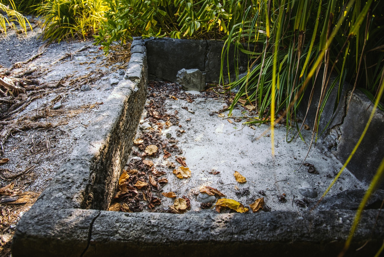
Lying just a few metres from the ‘English House’, through the spiky leaves and back out onto the isle’s edge, we were led to two graves just like that of Ahmed back up at Vehera Fannu. Isolated, surrounded by a short wall, and just yards from the beach, the burial ground fitted Bell’s description of the “lonely graves of two humble Maldivians” perfectly
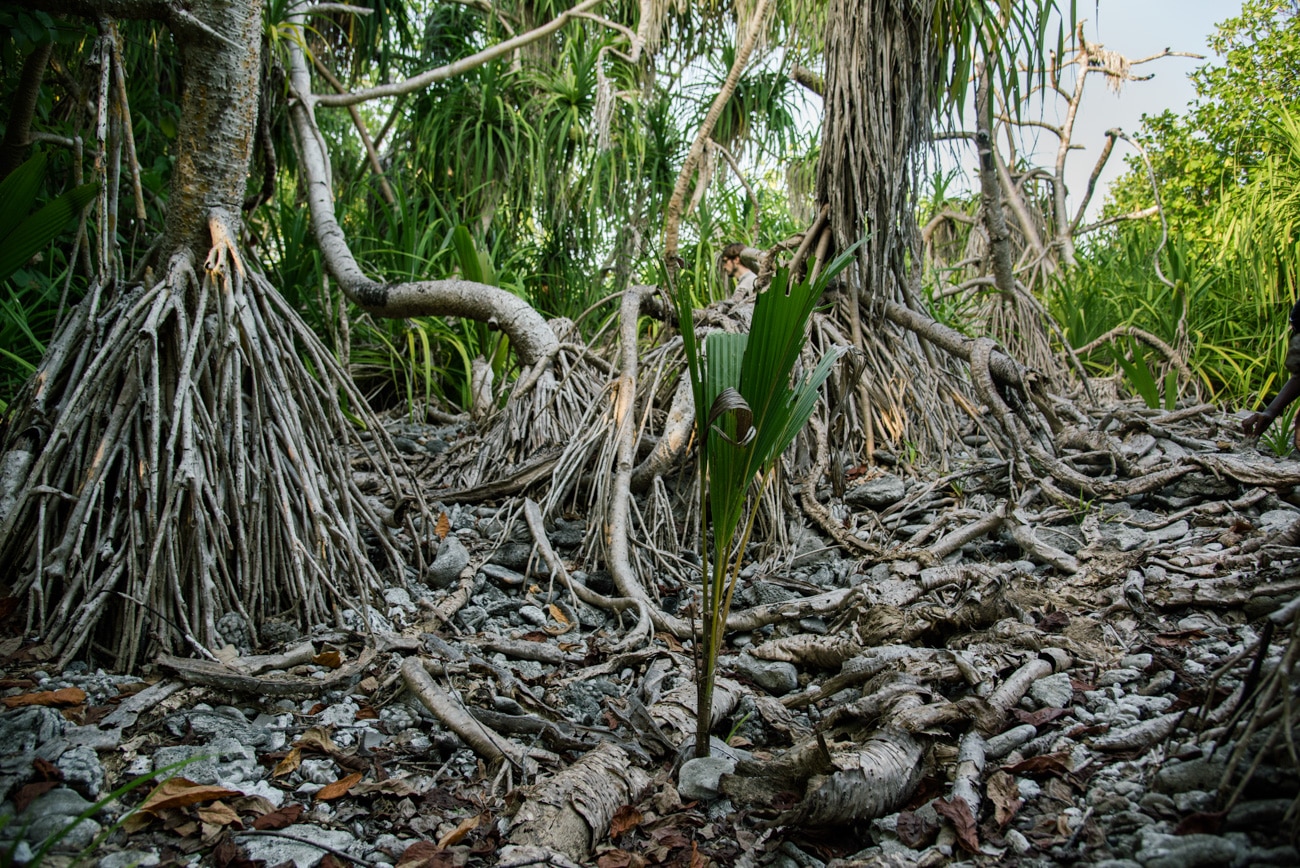
From here, the only way to find the ‘X’ that marked Bell’s spot was south. Skirting the shoreline, we headed back inland just a few feet before the standard scattering of coral beneath our feet turned into mounds of larger rubble, rolling beneath the screwpine and scrub that seemed to be wrestling to reinhabit the area.
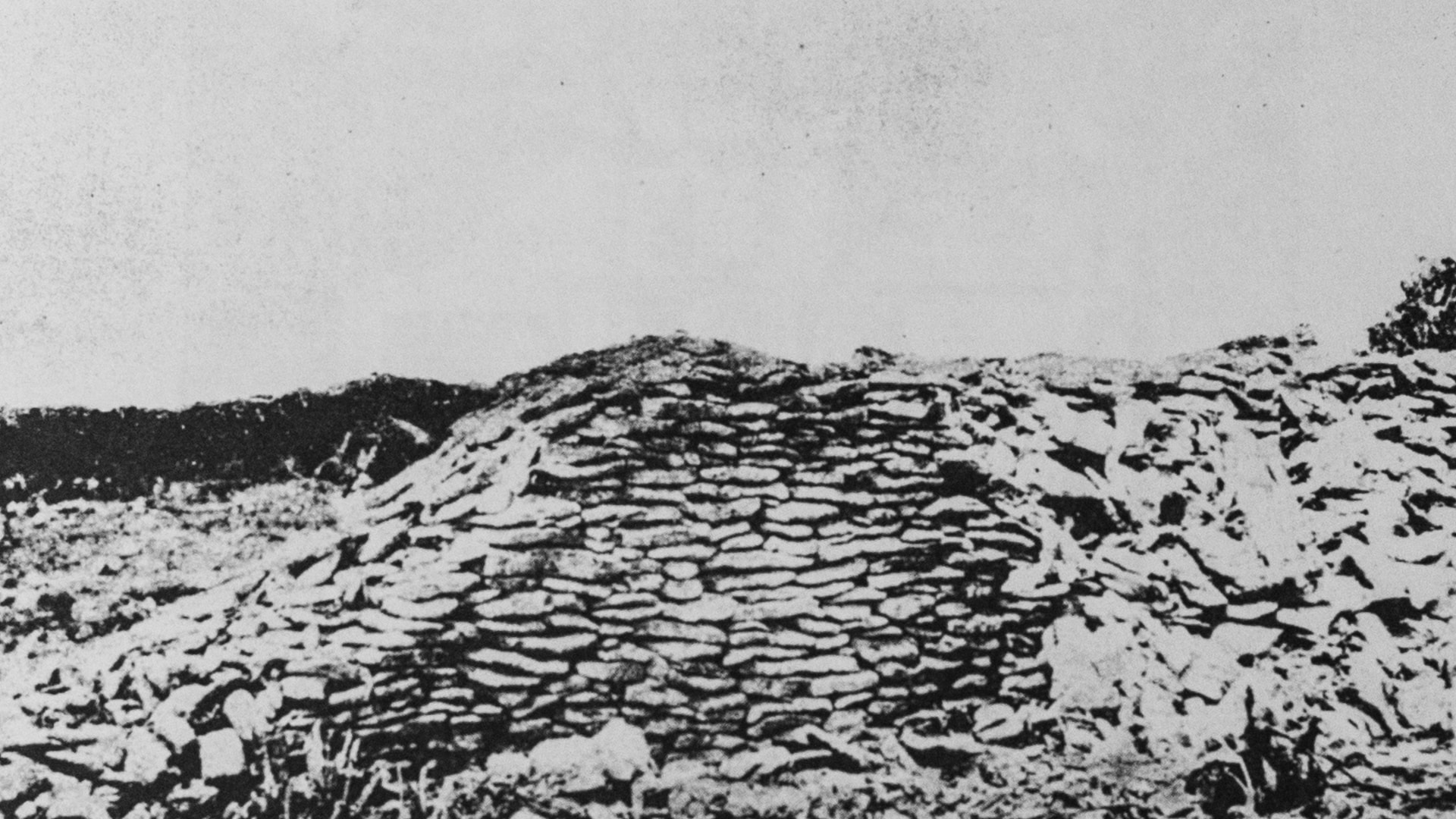
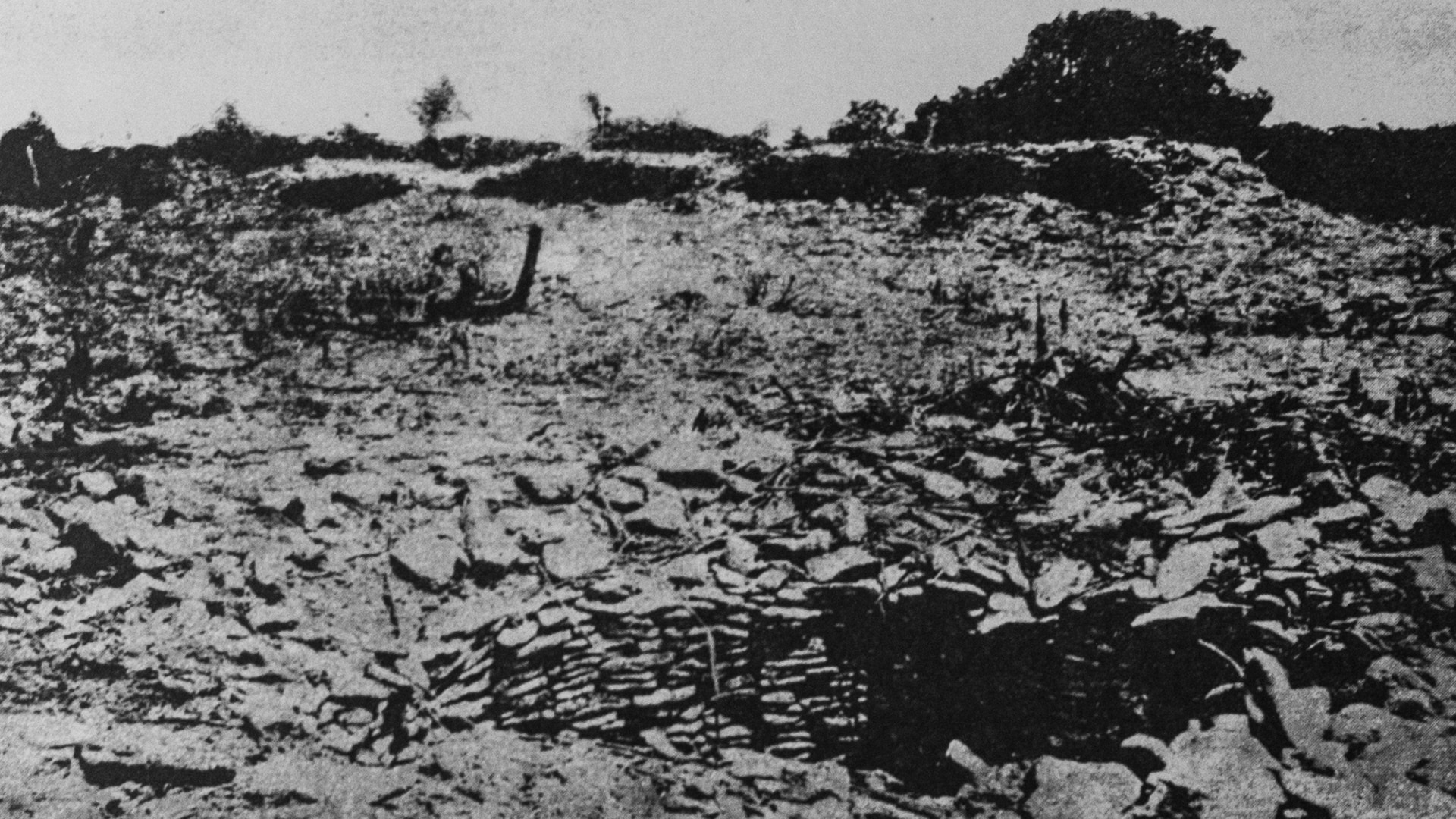
With only two grainy photographs to guide us further, the impossibility of identifying the fort with any real certainty dawned on us. The British archaeologist had reported very little beyond some coral ramparts standing a few feet tall, noting that there was no mortar on the eight-feet thick walls to prevent the steady removal of scarce construction materials over the centuries.
Were this the site, it seems clear that anything local builders could find of use had been removed decades ago, leaving little activity to interrupt the trees’ patchy growth. The well seen in 1922 – by then reduced to only three feet deep – could now have become any one of the depressions from which trees have sprouted in a site whose memories are now surely lost beneath the sands (and rocks, and bushes) of time.
Treasure Island
Or perhaps we were wrong and Bell’s fort lies elsewhere in the thick foliage. The clues seem to lead to this spot, but our search typifies much of Maldivian history; following old directions to evidence eroded by a combination of necessity, nature, and neglect.
A more thorough search of the area – taking on razor sharp foliage with machetes and thick trousers – would be needed to determine if the rubble area matches the measurements in Bell’s research. Even then, the successful searches for Buddhist remnants are unlikely to be replicated here, searching for a structure far less sophisticated in its original design.
Nevertheless, the fort’s architectural simplicity when compared with structures discovered elsewhere, is surely overcome by the names that still resonate within. As with much local history, most of the answers are probably buried, not in the sand, but in the stories and memories of islanders. Ancestors, heirs and great-great grandchildren.
But anyone who cares to look around Koattey is likely to find evidence of a rich and vibrant history. It is in as much need of protection and understanding as its surrounding environment.
Leave a comment